Nepal Flood 2026 explained. Discover what caused the massive flash flood near the China border, including extreme rainfall, glacial lake risks, landslides, rapid water rise, and other factors behind the devastating flooding.
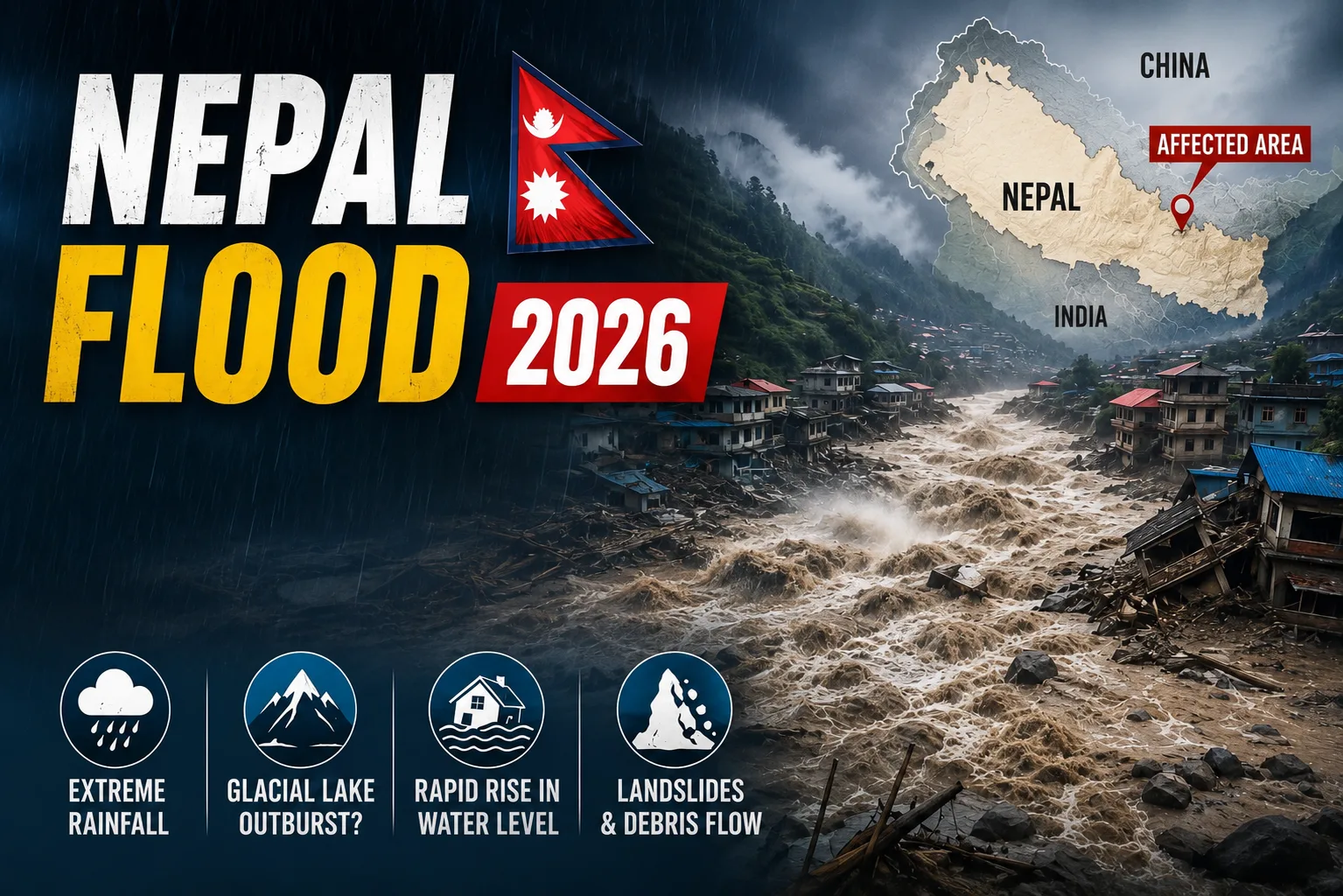
A massive flash flood hit the Nepal-China (Tibet) border area on 26 August 2026. At least 175 people were reported dead, while more than 1,000 remained missing, including foreign tourists and pilgrims. It caused major destruction in the Himalayan region. Rasuwa district, north of Kathmandu, was one of the worst-affected areas. A sudden flow of water, ice, rocks, mud and other debris moved through the river valleys. Roads, bridges, houses, vehicles and communication systems were badly damaged. The flood also affected important infrastructure and power projects. By 27 August, more than 160 people had been reported dead, while hundreds of people were still missing. The number was changing as rescue teams continued searching for people. Indian nationals were also among those reported missing, with reports putting the number at around 133. The floods were not a normal flood caused only by rainfall. Nepal flash floods were caused by glacial collapse, not an earthquake, according to the latest findings. A major glacial collapse and ice-rock avalanche triggered a powerful debris flow and sudden flooding.
The massive flow carried ice, rocks, mud and debris downstream, causing widespread destruction in nearby villages and settlements. The sudden release of water and debris made the flooding extremely dangerous and difficult to predict. The exact sequence of events is still being studied by experts.
What Caused the Nepal Flood?
The deadly flash floods in Nepal and Tibet were triggered by a massive glacial collapse and ice-rock avalanche on August 26, 2026. The collapse unleashed a powerful surge of water, mud, ice, and debris, which tore through the Lhende Khola river valley, causing widespread destruction downstream. The main explanation for the sudden flood is a large collapse of ice and rocks in the Himalayan region. A huge mass of ice and rock broke away from a mountain and moved quickly down towards the valley. The falling ice and rocks created a powerful flow of debris. It also pushed water and other material into the river system. This made the river rise suddenly and become very dangerous. The Bhote Koshi River and nearby river channels were badly affected. The debris-laden flow entered the wider river system and moved downstream.
- A large mass of ice and rock collapsed.
- The material moved quickly down the mountain.
- Ice, water, rocks and mud entered the river system.
- The river suddenly became much larger and faster.
- The flow moved downstream through narrow mountain valleys.
- Roads, bridges, houses and vehicles were swept away.
The US Geological Survey (USGS) later said that the seismic activity first reported as an earthquake was linked to a magnitude 5.2 glacial collapse and debris flow, not a normal earthquake.
Why is Rasuwa District Important?
Rasuwa is a mountainous district in northern Nepal, close to the China border. It has high mountains, glaciers and narrow river valleys. The Bhote Koshi River flows through this area and is part of the wider Himalayan river system. The area is also connected to the Trishuli River system. Because of its geography, Rasuwa is more vulnerable to sudden floods, landslides and debris flows. A large amount of water, ice or debris entering a narrow mountain valley can move very quickly. Rasuwa is also an important route between Nepal and China. Roads, bridges, settlements, hydropower projects and tourist routes are in the area. Because of this, the sudden flood caused major damage to roads, transport, power and communication systems.
What Happened to the Glacier?
A large mass of ice and rock reportedly broke away from the mountain and moved down towards the valley. The collapse happened at a high altitude and created strong vibrations in the ground. At first, the seismic activity was reported as a 4.4-magnitude earthquake. Later, the USGS clarified that the signal was caused by a glacial collapse and debris flow, not a normal earthquake. The USGS later upgraded the seismic event to magnitude 5.2 and said that no earthquake had occurred. Such an event can be called an ice avalanche, ice-rock avalanche or glacial collapse. When a large amount of ice and rock suddenly falls down a steep mountain, it can push water, mud and debris into a river. This can quickly turn into a destructive flash flood.
What is Inside a Glacier?
Inside a glacier, you can find extremely dense blue ice, trapped air bubbles, rock debris, and tunnels of flowing meltwater. A glacier is mainly made of ice. But when a glacier collapses, it can also carry rocks, snow, sediment and water downhill. When a large section of ice and rock breaks away, these materials can move together at very high speed.
- Ice: A huge amount of ice can suddenly move downhill.
- Water: Meltwater and other water can add to the flow.
- Rocks: Large rocks can move along with the ice and debris.
- Mud and sediment: These make the flow heavier and more destructive.
This is why a glacial collapse, and debris flow can look like a huge wall of water, mud, ice and rocks.
Why is an Ice Avalanche Flood More Dangerous?
A flood caused by a glacial collapse can be extremely dangerous because it can happen with very little warning. A normal flood may develop after heavy or prolonged rainfall. This can give people some time to move to safer places. But a sudden glacial collapse can send a huge amount of water and debris into a valley within a very short time. The flood can also carry large rocks, mud and other debris at high speed.
Major dangers include: -
- Very little warning time
- Extremely fast-moving water
- Large rocks and debris
- Destruction of roads and bridges
- Damage to houses and vehicles
- Loss of communication
- Difficulty in rescue operations
Was It an Earthquake or Glacier Collapse?
At first, the event was reported as a 4.4-magnitude earthquake because earthquake-monitoring systems detected strong seismic activity in the area. However, the US Geological Survey later clarified that the seismic signal was linked to a glacial collapse and debris flow, rather than a normal earthquake. The event was classified by the USGS as a magnitude 5.2 glacial collapse. A huge mass of ice, rock and debris falling from a mountain can create strong vibrations in the ground. These vibrations can be detected by instruments that are normally used to monitor earthquakes. So, although the event first appeared to be an earthquake, the available evidence shows that a glacial collapse and debris flow caused the disaster.
Why Did the Glacier Collapse?
Scientists and authorities are still studying the exact cause of the collapse. It would be too early to say that climate change alone caused this particular event. However, climate change is an important concern in the Himalayan region. Rising temperatures are causing glaciers to lose ice and change over time. Changes in ice, water and mountain conditions can make some glaciers and slopes less stable. Experts have also suggested that recent snow and ice melting may have added water to the glacier and possibly contributed to its instability. However, more research is needed to confirm the exact cause. Possible Glacier Collapse factors include: -
- Rising temperatures
- Glacier melting
- Changes in water pressure
- Weakening of ice and rocks
- Unstable mountain slopes
- Natural movement of glaciers
More scientific research is needed to understand exactly what caused the collapse and how different factors came together to cause the flood.
Hundreds Dead and Missing in Nepal
The flood caused a major humanitarian crisis near the Nepal-China border. By 27 August, more than 1,300 people were still missing after deadly floodwater wiped out villages, while more than 160 people had been reported dead. The exact numbers were changing as rescue teams searched affected areas and authorities updated their records. Local residents, workers and tourists were among those affected. Indian nationals were also reported missing, with the latest reports putting the number at around 133 Indian nationals. Many foreign tourists and pilgrims were travelling towards Tibet for the Kailash Mansarovar pilgrimage when the disaster happened. The destruction of roads and communication networks has made rescue operations even more difficult.
Why is There a Risk of Another Flood?
Authorities have warned people to remain alert because the danger may not be completely over. After a major glacier collapse, landslide or debris flow, mountain slopes can remain unstable. More ice or rocks could fall. Water can also become temporarily trapped behind debris and then suddenly move downstream. Experts have warned that a blockage upstream could create another flood. People living near rivers should follow official warnings and avoid dangerous riverbank areas until authorities say it is safe.
Why are Bihar and Uttar Pradesh at Risk?
The situation in Nepal is also important for parts of Bihar and Uttar Pradesh because several rivers connected to Nepal flow into India. The Gandak-Narayani river system is particularly important because it flows from Nepal into India. A rise in water levels can affect downstream areas. The Kosi is another major river system connected with Nepal and Bihar. However, it is a separate river basin from the Gandak-Narayani system. Indian authorities have been monitoring the situation and river levels. The possible downstream impact has made the situation important for areas in northern India.
Nepal Under Water: PM Modi Offers All Possible Help during Flash Flood Disaster
On August 26, 2026, Prime Minister Narendra Modi spoke with Nepal’s Prime Minister Balendra Shah, popularly known as Balen Shah, and offered India’s full support, including humanitarian assistance and disaster relief, in the wake of the devastating flash floods. Prime Minister of India Modi expressed condolences over the loss of lives and offered India’s support for rescue and relief operations. India has also been monitoring the situation because the disaster has affected Indian nationals and could have consequences for downstream areas.
Nepal Flood 2026: Key Takeaway
The Nepal flood of 26 August 2026 was a sudden and highly destructive disaster near the Nepal-China border. Available evidence points to a glacial collapse and ice-rock debris flow as the main trigger. The collapse created strong seismic vibrations and sent water, ice, rocks, mud and debris into the river system. The event shows how dangerous sudden disasters can be in the Himalayan region. It also highlights the need for better monitoring of glaciers, mountain slopes and rivers so that people can receive warnings as early as possible. The exact scientific sequence of the disaster is still being studied. However, the event clearly shows how quickly a glacial collapse in the Himalayas can turn into a devastating flash flood downstream.
Author Source - https://www.thehindu.com/news/international/nepal-flash-floods-increasing-death-toll-many-missing-rescuers-search-for-survivors-live-updates-august-27-2026/article71394802.ece