Nepal reclaiming Lipulekh is an old battle over different Indian Territory rights with Chinese interference in the Himalayas in terms of geopolitics.

The current dispute between Nepal and India regarding infrastructural developments along the Lipulekh-based on the latter country touching up its national map as recently did Nepal under its then Prime Minister K P Oli. This territorial claim that includes the Kalapani, Lipulekh, and Limpiyadhura is the result of many blending factors including history treaties and cartographic developments as well as nationalistic politics.Lipulekh is of strategic importance to India. The spatial context of access to the Sino-Indian border compounded by the nature of relationships in the Himalayas also increases the significance of the region in the larger security and connectivity realms. At the same time, it is the unspoken part that China playsespecially in bilateral deals and development projects with India that gives the situation a third dimension that Nepal finds it difficult to deal with.The history of the Lipulekh dispute, the reason behind the Nepalese boundary redraw, and the Indian justification in light of Chinese interventions are all examined in this article.It will attempt to place this problem into the scope of South Asia geopolitics, the sovereignty debate, and how to deal with contested borderlands.
Context of the Lipulekh region
The region has a strategic and historic importance due to the trai-junction. The issue regarding its status is based on the colonial period treaties and the changing territorial claims during the post-independence history.
Sugauli Treaty and the Colonial-era
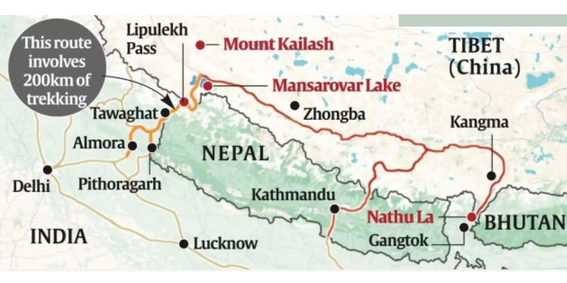
This territorial confusion over Lipulekh can be attributed to the Treaty of Sugauli [1816] between the British East India Company and the Kingdom of Nepal that was signed after the Anglo-Nepalese War. Nepal considered the Kali River as the western boundary and it was until then and problematic to find the start point of the river. Later British surveyors interpreted the head of the river as being located to the east of Lipulekh thus putting the area on the boundary of British India. Nepal argues that the river actually starts in Limpiyadhura thus claiming Kalapani and Lipulekh as a part of their territory (Adhikari, 2020).
The Practices of Cartography after Independence
Since the Indian independence in 1947 and the transformation of Nepal into a constitutional monarchy, both countries still used colonial-era maps to use as administrative sources. India also exercised a stable presence on the region and deployed her army following the 1962 Sino-Indian war. Nepal made no formal claims and was relatively quiet on the subject until the late 20th century. The bilateral failure to demarcate their boundaries in this sector meant that the level of uncertainty has remained high, due to which India has been able to establish infrastructure and to retain a degree of strategic control with little or no interference.
The 21st Century Dispute
This dispute came to particular prominence in 2020 when the government of Nepal, with Prime Minister K P Sharma Oli, created a new version of its political map that included Lipulekh, Kalapani, and Limpiyadhura. This step was being described as an adjustment of historical oversight and a re-enforcement of sovereignty. It represented a change to the past diplomatic discretion and introduced a cartographic nationalism into the politics of Nepal
Political Motivation and Map Amendment of 2020
The map amendment of Nepal in 2020 has had a strong influence on the historical aspects of the state and symbolized a change in perspective in its external policy due to a transition in politics and the ways of thinking in Nepal due to recent nationalistic growth within the country.
Legislative Claim and Symbolic Sovereignty
In May 2020, the Government of Nepal published a newer version of the political map including Kalapani, Lipulekh and Limpiyadhura areas that were under Indian administration but which Nepal argued were part of it according to their Sugauli Treatyinterpretation of 1816. Parliament quickly followed up with an endorsement of the map by constitutional amendment, a conscious statement of sovereignty. This was not the only cartographic action done as this legislative act was symbolic of Nepal trying to reinvent its territorial identity and confront what it perceived as historical injustices.
Domestic Political Considerations and National Mobilisation
The amendment came at a time when there were rising domestic pressures against Prime Minister Oli whose leadership became the subject of criticism over the matter of governance and intra party wrangles. The change of the map was a unifying nationalist act appealing to the national sentiments and ensuring politicalsupport. When the Oli administration framed the problem as a national issue of dignity, it managed to shift the political rhetoric of internal and domestic challenges back to an external discourse of sovereignty. This tactic resonated well with the youth and civil society of Nepal
Diplomatic consequences and strategic Signalling
The Nepal cartographic claim proved to be a hurdle in the bilateral relations between Nepal and India, which denounced the new map as unilateral and historically invalid. The amendment was also an indicator of Kathmandu being uneasy with the India-China cooperation in the Lipulekh area, especially when they signed agreements concerning infrastructure that could bypass Nepalese roads. Though the move did not change ground realities, it brought about a new twist to diplomatic strategies, forcing India to redefine its policies in dealing with the region, and a sense of geopolitical leverage among the new players within the region.
The Strategic importance of Lipulekh to India
The Lipulekh Pass in the greater Himalayas is in the tri-junction region of India-Nepal-China and has long-term strategic implicationsfor India based on the military, diplomatic, and infrastructure requirements of India in the area.
Military and surveillance
Lipulekh functions as an important stepping-stone to the territorial defense system of India in the north. The pass places India in an advantageous position as far as being able to keep an eye on cross-border activities and develop some strategic depth in the Pithoragarh district of the Indian state of Uttarakhand is concerned, because India is close to the Line of Actual Control (LAC) with China. Since the 1962 Sino-Indian war, India has reasserted its troop presence in the area, realizing that it would allow high altitude surveillance of China, and quick mobilization of troops if a conflict arose. Further, its altitude and topographic features provide it with a geographical advantage, turning it into a fulcrum in the Indian Himalayan security equation.
Connectivity and Pilgrimage Corridor
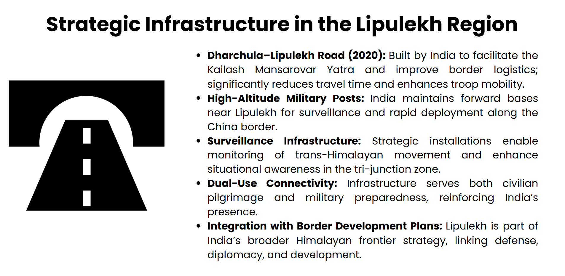
Kailash Mansarovar Yatra is a spiritual pilgrimage that passes through the pass by Indian pilgrims, the devotees on their way to Tibet. In 2020, India made considerable progress by creating a road connectingDharchula with Lipulekh, thus greatly decreasing the time of travel and increasing accessibility. This infrastructural development not only increased the flow of movements of the civilians but also positively contributed to the logistical operations of border management of borders. The twofold purpose of the road in terms of religious and strategic aims also highlights the fact that India wants to reinforce its influence by means of soft and hard power.
The Diplomatic Leverage and Regional Stability
India has a long history of unilateral promises and agreements with China. These arrangements, however, have been criticized by Nepal,which considers such to be exclusionary. The strategic importance of keeping operational control over Lipulekh is not just important to India in terms of national security, but also an important way of exercising its influence over a geopolitically strategic pass. The pass, therefore, represents a combination of an interest in defense, diplomacy and development.
The China Angle: Geopolitical and Strategic Dimensions
The Lipulekh region is not directly involved in the conflict between India and China, but it provides an important aspect to the debate over territory. Its strategy is formed by its geopolitics towards and its bilateral relations.
The bilateral agreements and the exclusion of Nepal
In 2015, India and China came to an arrangement to increase commerce and pilgrimage access through Lipulekh, especially the Kailash Mansarovar Yatra. This bilateral agreement was made without the consultation of Nepal, and this created some diplomatic tension with Kathmandu. Nepal interpreted the agreement to be in disregard of its sovereign rights to its territory. The omission indicated that in areas of border disputes, China favours bilateralism.
Strategic Buffer and Border Management
To China, Lipulekh belongs to an extended security zone against the Tibet frontier. The availability of access to the Gorkha region due to its topographical and geographical location close to the Indian state of Uttarakhand and Nepal, Darchula district, makes the region a sensitive area of monitoring trans-Himalayan movement. The infrastructure facilities built by China in China including road networks and surveillance facilities, are indications of its plans to maintain control and eliminate the imminence of instability. Whilst China has not made any open declaration supporting the Nepal claims, the silence coupled with the influence that it holds on both neighboursserves a specific purpose of not making a stand but at the same time holding leverage over the two neighbours.
Regional power dynamics
The measured interest that China shows in the sovereignty issue of Lipulekh can be viewed as a part of its larger South Asian policy, which is to exercise influence without making explicit commitments in the bilateral contention. In the case of China, India requires increased attention and planning of infrastructure movements. The ambivalence on the part of Chinese can remind the world of how weak its bargaining power can be in a trilateral context in the case of Nepal. The Lipulekh incident, therefore, demonstrates how the geopolitical calculus of China influences the regional orientation, with regional alignments mostly taking precedence over normative diplomacy.
India Diplomatic and Strategic Response
The reaction of India to the mapping of change by Nepal and its protests against Lipulekh has been a combination of restraint in foreign policy and forcefulness in strategic policy, which is indicative of its overall approach to the region and security interests.
Historical and Administrative continuity
India opposed the updated map created by Nepal as unilateral and non-historic and added that the territories inhabited by Nepal had been under the administration of India for a long time. The Ministry of External Affairs explained that there was an ongoing practice in cartographic and on-ground governance going back to colonial times, and that it is inferred that the Lipulekhis an Indian territory as per the prevailing boundaries. This restatement was supposed to work as a preservation effort of the status quo, avoiding escalation (MEA, 2020).
Strategic Infrastructure, Border Management
With diplomatic tensions, India still went on with its infrastructural growth in the region, such as the road connecting Dharchula and Lipulekh. This action and the border management were packaged as a part of the logistical upgrading of the Kailash Mansarovar Yatra, but also as a deliberate show of India'sintention to establish control. Such infrastructure has a dual purpose, both civilian and military, which is a representation of the deterrence through development strategy India uses in the Himalayas.
Quiet Diplomacy
India chose restrained diplomacy instead of making a loud voice of contention. Although Nepal was rejected within its claims, it kept open channels of dialogue and stressed historical ties and respect. This strategy will be in line with India's Active Neighbourhood First policy, which aims to maintain equilibrium between its strategic concerns and regional stability issues.
Conclusion
The border tension over Lipulekh offers the essence of this South Asian high altitude frontier with the dynamics of history, sovereignty and strategic appraisals. The recent 2020 map revision that Nepal undertook due to the pressures of internal politics and historical revisionism questioned India and its administrative jurisdiction since a long time ago, and created new complications in the relations between both states. In light of India's shifting ties with China, Lipulekh is a crucial military, logistical, and symbolicroute to India. In the meantime, Nepal finds the situation more complicated due to China and India's covert involvement and bilateral agreements, which favour the unequal nature of the three-party exchanges. The episode exposes how cartographic claims could be used as a tool of nationalist rousing and symbols of geopolitical gesturing. Moving into a resolution, we are going to need not only to be historically clear, but to have a sustained dialogue and respect towards each other and the mutual interests within that region. To traverse such contested spaces, South Asian states have to strike a balance between the strategic nature of relations and cooperative frameworks to maintain stability, trust and long-term harmony in the Himalayan region.