India has reaffirmed that Ladakh is an integral and inalienable part of India after China opposed India's decision to assign standardised names to 28 locations and geographical features in the Union Territory. The disagreement highlights the continuing border dispute between the two countries and the strategic importance of official mapping in the region.
Why in the News?
On October 13, 2026, China objected to India's decision to standardise the names of 28 locations in Ladakh, describing the move as illegal and invalid. India's Ministry of External Affairs (MEA), through spokesperson Randhir Jaiswal, rejected China's position and stated that no amount of denial could change the fact that Ladakh is an integral part of India.
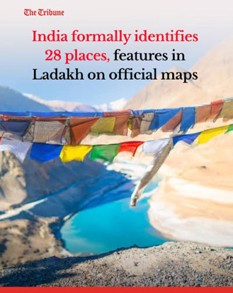
1. India's Decision to Standardise Names
On October 2, 2026, the Government of India assigned standardised names to 28 places and geographical features in Ladakh on the official map of the Survey of India (SoI). The decision was taken in consultation with the Ladakh Union Territory administration and local stakeholders. Its main objectives are:
Accurate identification: Ensure consistent identification of geographical locations.
Standardised cartography: Maintain uniform place names on official maps.
Public awareness: Improve awareness of important geographical and strategic locations.
Border documentation: Support the precise identification of sensitive areas along the Line of Actual Control.
The identified locations include Gogra and Hot Springs, which were important friction points during the 2020 India-China border standoff.
2. China's Objection and India's Response
China opposed India's decision, reiterating its claim over the disputed areas in the western sector of the India-China boundary.
China's position: Chinese Foreign Ministry spokesperson Mao Ning stated that Beijing does not recognise the Union Territory of Ladakh and described India's naming decision as illegal and invalid.
India's position: The Ministry of External Affairs (MEA) reaffirmed that Ladakh is an integral and inalienable part of India.
India's explanation: The standardised names are intended to improve geographical identification and public awareness through official maps.
The disagreement reflects the two countries' differing positions on territorial claims and the status of areas along their disputed boundary.
3. Important Locations Identified in Ladakh
The 28 locations include mountains, peaks, glaciers, passes, valleys, rivers, and other geographical features.
Category | Examples |
Border friction points | Gogra, Hot Springs |
Peaks and mountains | Alisha Giri, Kanishka Peak, Zorawar Peak, Karun Pir |
Passes | Chapchingal Pass, Shachmirik Pass |
Glaciers | Parpik Glacier, Skamri Glacier |
Valleys and rivers | Shkorga Valley, Yangpa River |
Other locations | Kuksel, Panglung, Kumarayana Point, Dehra Compass |
Other identified features include Martand Giri, Drak Karpo, Rinchen Zangpo, Guru Rinpoche, Marpa Lotsava Ri, Milarepa Kangri, Shiva Ri and Maheshwara Ri.
4. Strategic Importance of Gogra and Hot Springs
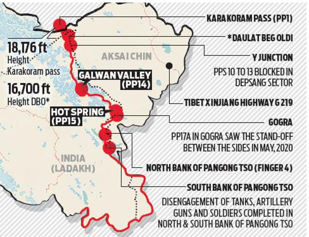
Gogra and Hot Springs are important locations along the Line of Actual Control (LAC), the de facto boundary separating Indian- and Chinese-controlled territories. Both locations became significant during the 2020 border standoff between Indian and Chinese forces.
The eastern Ladakh standoff began on May 5, 2020, following a violent clash in the Pangong Lake area.
Gogra and Hot Springs became important friction points during the confrontation.
India and China began the disengagement process in 2022.
These areas remain strategically important for border management and Indian patrolling.
5. Significance for India-China Relations
The disagreement highlights the importance of geographical documentation and border management in a region where the two countries maintain competing territorial claims.
Territorial sovereignty: India continues to assert its sovereignty over Ladakh.
Border security: Accurate identification of geographical features is important for monitoring sensitive areas.
Strategic mapping: Standardised names support consistency in official maps and geographical records.
Bilateral relations: Disagreements over territorial claims continue to affect India-China relations.
Public awareness: Official mapping helps improve understanding of the region's geography.
Conclusion
India's decision to standardise the names of 28 locations in Ladakh has drawn strong opposition from China. While India maintains that the exercise improves geographical identification and public awareness, the disagreement reflects the continuing territorial dispute along the India-China boundary. Border management, territorial sovereignty, and accurate geographical documentation remain important aspects of India's strategic interests in Ladakh.
Test your understanding
Questions from this article
Prelims practiceQuestion: With reference to India-China Naming Dispute: 28 Locations in Ladakh Under Scrutiny, consider the following statements:
- India has reaffirmed that Ladakh is an integral and inalienable part of India after China opposed India's decision to assign standardised names to 28 locations and geographical features in.
- The disagreement highlights the continuing border dispute between the two countries and the strategic importance of official mapping in the region
Which of the statements given above is/are correct?
- 1 only
- 2 only
- Both 1 and 2
- Neither 1 nor 2
View answer and explanation
Suggested answer: (c) Both 1 and 2
Explanation: The India-China naming dispute over 28 locations in Ladakh, its geopolitical significance, territorial sensitivities, and implications for bilateral relations
Mains practiceQuestion: Discuss India-China Naming Dispute: 28 Locations in Ladakh Under Scrutiny with reference to Why in the News?, 1. India's Decision to Standardise Names, 2. China's Objection and India's Response and 3. Important Locations Identified in Ladakh. (150 words, 10 marks)
View answer-writing approach
Answer approach:
- Introduce the topic using its meaning and context.
- Explain Why in the News?, 1. India's Decision to Standardise Names, 2. China's Objection and India's Response and 3. Important Locations Identified in Ladakh.
- Use facts and examples given in the article.
- Conclude with a balanced way forward.
Frequently asked questionsFrequently asked questions
What is India-China Naming Dispute: 28 Locations in Ladakh Under Scrutiny?
The India-China naming dispute over 28 locations in Ladakh, its geopolitical significance, territorial sensitivities, and implications for bilateral relations
Why is India-China Naming Dispute: 28 Locations in Ladakh Under Scrutiny relevant for UPSC preparation?
The disagreement highlights the continuing border dispute between the two countries and the strategic importance of official mapping in the region
What key points should aspirants remember about India-China Naming Dispute: 28 Locations in Ladakh Under Scrutiny?
The article covers Why in the News?, 1. India's Decision to Standardise Names, 2. China's Objection and India's Response and 3. Important Locations Identified in Ladakh.